Identificatie
referentie code
IE LMOD 438
Titel
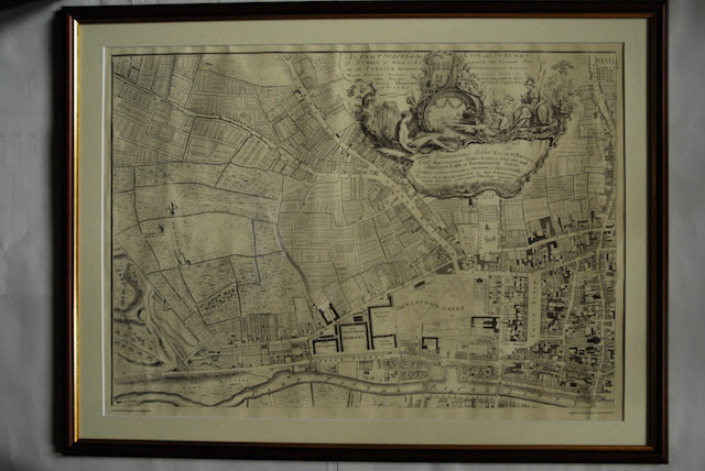
1756 John Roque Map of Dublin No. 1 (North West Dublin)
Datum(s)
- Twentieth Century (Vervaardig)
Beschrijvingsniveau
Stuk
Omvang en medium
Paper, ink. 52 x 72.5 cm
Context
Naam van de archiefvormer
Biografie
Geschiedenis van het archief
10/05/2011
Inhoud en structuur
Bereik en inhoud
Map of part of North West Dublin. Black and white map showing from part of the Phoenix Park to Smithfield, the Liffey to Cabra Lane. ‘An Exact Survey of the City and Suburbs of Dublin in Which is expressed the Ground Plot of all Publick buildings dwelling Houses, warehouses, stables, courts, yards’