Identificatie
referentie code
IE LMOD 437
Titel
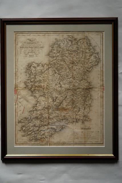
1837 Map of Ireland for Lewis Atlas of Ireland
Datum(s)
- Twentieth Century (Vervaardig)
Beschrijvingsniveau
Stuk
Omvang en medium
Paper, ink. 51 x 40.5 cm
Context
Naam van de archiefvormer
Biografie
Geschiedenis van het archief
26/07/2011
Inhoud en structuur
Bereik en inhoud
‘Map of Ireland divided into Provinces and Counties, showing the principal roads, railways, rivers and canals and the distance in Irish Miles and furlongs of each City and Post Town from Dublin.’ Map of Ireland for Lewis Atlas of Ireland, June 27th.
Waardering, vernietiging en slectie
Aanvullingen
Ordeningstelsel
Voorwaarden voor raadpleging
Voorwaarden voor reproductie
Taal van het materiaal
Schrift van het materiaal
Taal en schrift aantekeningen
Fysieke eigenschappen en technische eisen
Discolouring from age, creases from folding and some tears along the creases.