Área de identidad
Código de referencia
IE LMOD 437
Título
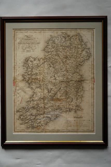
1837 Map of Ireland for Lewis Atlas of Ireland
Fecha(s)
- Twentieth Century (Creación)
Nivel de descripción
Unidad documental simple
Volumen y soporte
Paper, ink. 51 x 40.5 cm
Área de contexto
Nombre del productor
Historia biográfica
Historia archivística
26/07/2011
Área de contenido y estructura
Alcance y contenido
‘Map of Ireland divided into Provinces and Counties, showing the principal roads, railways, rivers and canals and the distance in Irish Miles and furlongs of each City and Post Town from Dublin.’ Map of Ireland for Lewis Atlas of Ireland, June 27th.
Valorización, destrucción y programación
Acumulaciones
Sistema de arreglo
Condiciones de acceso
Condiciones
Idioma del material
Escritura del material
Notas sobre las lenguas y escrituras
Características físicas y requisitos técnicos
Discolouring from age, creases from folding and some tears along the creases.