Identificatie
referentie code
IE LMOD 327
Titel
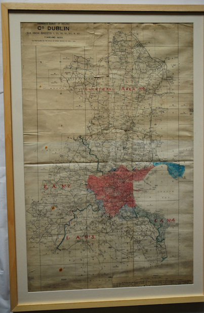
Map of Dublin Electoral Areas
Datum(s)
- Twentieth Century (Vervaardig)
Beschrijvingsniveau
Stuk
Omvang en medium
paper, ink. 88 x 57 cm
Context
Naam van de archiefvormer
Biografie
Geschiedenis van het archief
13/07/2011
Inhoud en structuur
Bereik en inhoud
The map shows whole of Dublin and electoral areas. Ordnance Survey of Ireland, Co Dublin
Waardering, vernietiging en slectie
Aanvullingen
Ordeningstelsel
Voorwaarden voor raadpleging
Voorwaarden voor reproductie
Taal van het materiaal
Schrift van het materiaal
Taal en schrift aantekeningen
Fysieke eigenschappen en technische eisen
Slight discolouring from age, creases from folding, wear and tear along edges. Black stain along the bottom and a handful of rust coloured spots.